Showing posts with label volcano. Show all posts

Sunday, 21 January 2024

MT LAMINGTON, THE VOLCANO IN PAPUA & NEW GUINEA

Today, The Grandma has been reading about Mount Lamington, the volcano in the Oro Province of Papua New Guinea, that erupted on a day like today in 1951.

Mount Lamington is an andesitic stratovolcano in the Oro Province of Papua New Guinea. The forested peak of the volcano had not been recognised as such until its devastating eruption in 1951 that caused about 3,000 deaths. The volcano rises to 1680 meters above the coastal plain north of the Owen Stanley Range. A summit complex of lava domes and crater remnants rises above a low-angle base of volcaniclastic deposits that are dissected by radial valleys. A prominent broad avalanche valley extends northward from the breached crater.

The mountain was named after Charles Cochrane-Baillie, 2nd Baron Lamington who was Governor of Queensland.

In early January 1951, a series of minor explosions and earthquakes rocked Mount Lamington, a volcano in Oro Province, Territory of Papua and New Guinea. Prior to the eruption, Mount Lamington was not recognized as a volcano due to the absence of historically-recorded eruptions and dense vegetation cover.

From January 15, volcanic activity intensified, and tall eruption plumes were generated. The largest eruption occurred on the morning of January 21 when a thick black plume of ash rose  15,000 m into the atmosphere.

The eruption collapsed a lava dome and produced a lethal pyroclastic flow that killed 2,942 people. In the years after the eruption, new lava domes formed and collapsed in succession. Activity persisted until July 1956. The eruption is the deadliest natural disaster in Australian history, as the region was under the rule of the Government of Australia.

Volcanism in Papua New Guinea is due to the ongoing subduction of oceanic crust beneath the island due to plate tectonics

Mount Lamington is situated within the Hydrographers Range; a small, forested coastal mountain range. The mountain range is the remnant of a heavily eroded Quaternary stratovolcano.

The dominant rock types are andesite and basaltic andesite. While a majority of the range's eruptive history occurred during the Pleistocene, the presence of cinder cones and craters on the southern flank of the range suggest volcanism also took place during the Holocene. The mountain lies adjacent to the Owen Stanley Range. Nearby volcanoes include Mount Suckling and Mount Victory.

More information: Volcano Hotspot

Mount Lamington rises to a height of 1,680 meters above the coastal flats north of the Owen Stanley Range. A summit complex of lava domes and crater remnants rises above a low-angle base of volcaniclastic deposits that are dissected by radial valleys. A prominent broad avalanche valley extends northward from the breached crater. The horseshoe-shaped crater was the result of a large prehistoric sector collapse.

Prior to the eruption in 1951, Mount Lamington was not known by locals to be an active volcano as no widespread ancient folklore or stories of the volcano existed among the native population. The only indication of volcanic activity was a small hot spring on the northern slopes, which was not known by most of the native population.

There were also settlements located on the flank of the volcano. A weak hint of its volcanic nature was a traditional story, related to the volcano's activity, of a lake on the summit which exploded, destroying villages and killing many people. The native population regards the mountain as a sacred and spiritual place.

Geologists however, understood that Mount Lamington and the Hydrographers Range were volcanic in origin, and that it was a geologically young feature. A geologist from the Netherlands classified Mount Lamington an active volcano. Only three eruptions were confirmed in the Holocene.

A number of inhabitants around Mount Lamington reported earthquakes in early January 1951. One eyewitness also saw a strange light on New Year's Day of 1951.

More information: PNGAA

On the morning of January 15, residents saw evidence of landslides in the crater wall of the volcano. Landslide scars identified as streaks of brown in the heavily forested volcano flank indicated the volcano was active. At a rubber plantation in Sangara, a village, a person reported white smoke or vapour cloud rising from the base of the volcano. Around the crater, vegetation was killed by the intense heat emitted from the ground.

The following day, January 16, a vapour cloud was seen from Higaturu. Large landslides were reported, many destroying the existing vegetation. The entire rainforest around the crater was destroyed by the late afternoon. An earthquake swarm occurred at 16:00. Up to 30 earthquakes were felt till 08:00 on January 17. Stronger earthquakes were felt in Isivita Mission, located northwest of the crater.

On January 17, an ash column rising between some hills and Mount Lamington was observed. The column grew larger as the hours passed. Earthquakes continued to be felt, and there was a red glow observed at night. By January 18, large plumes of dark grey ash ejected from the volcano. A large explosion occurred in the morning. A newly-constructed volcanic hill where volcanic material escaped was observed. The eruptions did not cause any human deaths, according to District Commissioner Cecil Cowley on January 19. Large columns of ash rising 6,100-7,600 m could be observed from Popondetta.

From Kokoda, the eruption was described as a large black column, and had a shape reminiscent of a cauliflower. Monsoon winds caused heavy ashfall on the southern side of the volcano. Some settlements where the Orokaiva people lived were damaged.

The most violent eruption occurred four days later at 10:40 local time. Occupants on two Qantas Empire Airways flights which flew in close proximity to the erupting volcano reported a large eruption column and base surge of pyroclastic debris. The captain of a Douglas DC3 flight witnessed a massive continuous column of black smoke erupting from the crater. The column rose over 4,300 m, punching through a layer of clouds. In two minutes, the column had risen 12,000 m from the crater, and expanded into a mushroom column. The captain of the DC 3 radioed authorities at Port Moresby about the sequence of events. Another Qantas flight; a de Havilland Dragon bound for Popondetta from Lae, was about to land when its occupants witnessed the side of volcano blow itself apart. A large surge of debris approached the aircraft, forcing its return to Lae.

The post-January 21 eruptive phase consisted of explosive eruptions which produced pyroclastic flows. A large pyroclastic flow was documented on March 5, 1951. After the climactic eruption on January 21, a new lava dome formed in the crater. The new lava dome grew to fill the crater. 

From 1951 to 1953, new lava domes formed and collapsed, generating more pyroclastic flows. The dome eventually attained a height of 450 metres from the crater floor to its summit and had a volume of 0.2 km3. A lava spine emerged from the dome and grew to a height of 150 m. Lava spines continuously formed and were destroyed over a five-year period.

Rough estimates of the death toll appeared as early as 23 January which suggested 4,000 deaths. A thorough count did not happen because bodies were buried within days to weeks of the disaster. Port Moresby officials conveyed to the Department of External Territories; 3,466 people dead or missing. An administration official in Port Moresby performed an investigation of the local population from August to October and concluded that 2,907 people died. The total death toll amounted to 2,942.

More information: Smithsonian Institution-Global Volcanism Program


People never believe in volcanoes
until the lava actually overtakes them.

George Santayana

Tuesday, 25 October 2022

MOUNT MERAPI ERUPTS IN YOGYAKARTA, INDONESIA

Today, The Grandma has been reading about Mount Merapi, the stratovolcano located in Yogyakarta, Indonesia, that erupted on a day like today in 2010.

Mount Merapi, Gunung Merapi (literally Fire Mountain in Indonesian and Javanese), is an active stratovolcano located on the border between the province of Central Java and the Special Region of Yogyakarta, Indonesia.

It is the most active volcano in Indonesia and has erupted regularly since 1548. It is located approximately 28 km north of Yogyakarta city which has a population of 2.4 million, and thousands of people live on the flanks of the volcano, with villages as high as 1,700 m above sea level.

Smoke can often be seen emerging from the mountaintop, and several eruptions have caused fatalities. A pyroclastic flow from a large explosion killed 27 people on 22 November 1994, mostly in the town of Muntilan, west of the volcano. Another large eruption occurred in 2006, shortly before the Yogyakarta earthquake. In light of the hazards that Merapi poses to populated areas, it was designated as one of the Decade Volcanoes.

On the afternoon of 25 October 2010, Merapi erupted on its southern and southeastern slopes. A total of 353 people were killed over the next month, while 350,000 were forced to flee their homes; most of the damage was done by pyroclastic flows, while heavy rain on 4 November created lahars which caused further damage. Most of the fissures had ceased erupting by 30 November, and four days later the official threat level was lowered. Merapi's characteristic shape was changed during the eruptions, with its height lowered 38 m to 2,930 m.

More information: Global Volcanism Program

Since 2010, Merapi had experienced several smaller eruptions, most noticeably two phreatic eruptions which occurred on 18 November 2013 and 11 May 2018. The first and larger of these, caused by a combination of rainfall and internal activity, saw smoke issued up to a height of 2,000 m. There have been several small eruptions since the beginning of 2020, which are of great interest to volcanologists.

The name Merapi is a compound of Sanskrit Meru meaning mountain with Javanese api which means fire. Thus Merapi can be loosely translated as Mountain of Fire or Fire Mountain.

In late October 2010, the Center for Volcanology and Geological Hazard Mitigation, Geological Agency (CVGHM), (Indonesian language-Pusat Vulkanologi & Mitigasi Bencana Geologi, Badan Geologi-PVMBG), reported that a pattern of increasing seismicity from Merapi had begun to emerge in early September.

Observers at Babadan 7 km west and Kaliurang 8 km south of the mountain reported hearing an avalanche on 12 September 2010.

On 13 September 2010, white plumes were observed rising 800 m above the crater. Lava dome inflation, detected since March, increased from background levels of 0.1 mm to 0.3 mm per day to a rate of 11 mm per day on 16 September.

On 19 September 2010, earthquakes continued to be numerous, and the next day CVGHM raised the Alert Level to 2 (on a scale of 1-4). Lava from Mount Merapi in Central Java began flowing down the Gendol River on 23-24 October signalling the likelihood of an imminent eruption.

On 25 October 2010, the Indonesian government raised the alert for Mount Merapi to its highest level (4) and warned villagers in threatened areas to move to safer ground. People living within a 10 km zone were told to evacuate. The evacuation orders affected at least 19,000 people; however, the number that complied at the time remained unclear to authorities. Officials said about 500 volcanic earthquakes had been recorded on the mountain over the weekend of 23-24 October, and that the magma had risen to about 1 km below the surface due to the seismic activity.

After a period of multiple eruptions considered to exceed the intensity and duration of those in 1872 on 10 November 2010 the intensity and frequency of eruptions was noticed to subside.

By this time, 153 people had been reported to have been killed and 320,000 were displaced. Later the eruptive activities again increased requiring a continuation of the Level 4 alert and continued provision of exclusion zones around the volcano. By 18 November the death toll had increased to 275. The toll had risen to 324 by 24 November and Syamsul Maarif, head of the National Disaster Mitigation Agency (BNPB) explained that the death toll had risen after a number of victims succumbed to severe burns and more bodies were found on the volcano's slopes.

In the aftermath of the more intensive eruptive activities in late November, Yogyakarta's Disaster Management Agency reported that there were about 500 reported cases of eruption survivors in Sleman district suffering from minor to severe psychological problems, and about 300 cases in Magelang. By 3 December the death toll had risen to 353.

Merapi is very important to Javanese, especially those living around its crater. As such, there are many myths and beliefs attached to Merapi.

More information: ESA


Those who seek power somewhere outside
rather than within themselves
should carefully look at the volcanoes!
All the power is within you!
And all you have to do is take it out!

Mehmet Murat Ildan

Thursday, 4 August 2022

MOUNT ASAMA, THE TENMEI ERUPTION & FAMINE IN 1783

Today, The Grandma has been reading about Mount Asama, the active complex volcano in Honshū, Japan, that erupted on a day like today in 1783.

Mount Asama (浅間山, Asama-yama) is an active complex volcano in central Honshū, the main island of Japan

The volcano is the most active on Honshū. The Japan Meteorological Agency classifies Mount Asama as rank A. It stands 2,568 metres above sea level on the border of Gunma and Nagano prefectures. It is included in 100 Famous Japanese Mountains.

Mount Asama sits at the conjunction of the Izu-Bonin-Mariana Arc and the Northeastern Japan Arc.

The mountain is built up from non-alkali mafic and pyroclastic volcanic rocks dating from the Late Pleistocene to the Holocene. The main rock type is andesite and dacite.

Scientists from the University of Tokyo and Nagoya University completed their first successful imaging experiment of the interior of the volcano in April 2007. By detecting sub-atomic particles called muons as they passed through the volcano after arriving from space, the scientists were able gradually to build up a picture of the interior, creating images of cavities through which lava was passing deep inside the volcano.

A University of Tokyo volcano observatory is located on the mountain's east slope. Volcanic gas emissions from this volcano are measured by a Multi-Component Gas Analyzer System, which detects pre-eruptive degassing of rising magmas, improving prediction of volcanic activity.

There is also another mountain called Asama (朝熊山, Asama-yama) of only 555 meters in Mie Prefecture.

The geologic features of this active volcano are closely monitored with seismographs and strategically positioned video cameras. Scientists have noted a range of textural variety in the ash which has been deposited in the region during the serial eruptions since the Tennin eruption of 1108.

The eruption of Mount Asama in 1108 (Tennin 1) has been the subject of studies by modern science. Records suggest that the magnitude of this plinian eruption was twice as large as that of the Tenmei catastrophe in 1783.

A Swiss research team found Mount Asama's volcanic eruption could have contributed to extreme weather that caused severe famine, torrential rain and consecutive cold summers in Europe. They studied ice cores in Greenland which had increased sulfate deposition in 1108 CE. In the late Heian Period (794-1185) the diary of the court noble Fujiwara no Munetada reported that Mount Asama erupted on 29 August 1108. He wrote that a local report described rice paddies and fields could not be farmed due to being covered by a thick layer of ash.

More information: Nippon

Mount Asama erupted in 1783 (Tenmei 3), causing widespread damage. The three-month-long plinian eruption that began on 9 May 1783, produced andesitic pumice falls, pyroclastic flows, lava flows, and enlarged the cone.

The climactic eruption began on 4 August and lasted for 15 hours, and contained pumice falls and pyroclastic flows. The complex features of this eruption are explained by rapid deposits of coarse pyroclastic ash near the vent and the subsequent flows of lava; and these events which were accompanied by a high eruption plume which generated further injections of pumice into the air.

The Onioshidashi (Japanese: 鬼押出し) is the name of lava flow on the northern slope of Mount Asama. The lava flow that erupted in 1783 Tenmei eruption was solidified. Now, it is known as a tourist destination.

The Asama Volcano Museum (浅間火山博物館), 4 km from the crater of the Mount Asama, open from 1993 to 2020, explained volcanoes.

The museum was in Naganohara-machi, Agatsuma-gun, Gunma Prefecture. As of early 2009, it was open from April until November.

Visitor numbers peaked at 265,000 in 1994; however, seismic activity at nearby Mount Asama was one reason for frequent closures. The closures were a factor in the drop in visitors this gradually fell to 23,000. In the later years of the museum, most of the visitors were on school excursions.

The museum was running a deficit of about 17 million yen per year, paid for by the town of Naganohara. Additionally, the building was ageing, and maintenance threatened to cost hundreds of millions of yen.

A nearby building, Asama memorial hall (浅間記念館) exhibited motorbikes; the plan in summer 2020 was to move these to a municipally owned tourist facility, Asama pasture (浅間牧場), and to move some of the exhibits of the volcano museum to the memorial hall.

More information: Japan Travel

You behold a range of exhausted volcanoes.
Not a flame flickers on a single pallid crest.

Benjamin Disraeli

Monday, 2 May 2022

CHAITÉN VOLCANO ERUPTS IN CHAITÉN, PALENA (CHILE)

The Grandma loves volcanoes, and she has been reading about Chaitén, the Chilean volcano that began erupting on a day like today in 2008.

Chaitén is a volcanic caldera 3 kilometres in diametre, 17 kilometres west of the elongated ice-capped Michinmahuida volcano and 10 kilometres northeast of the town of Chaitén, near the Gulf of Corcovado in southern Chile

The most recent eruptive phase of the volcano erupted on 2008. Originally, radiocarbon dating of older tephra from the volcano suggested that its last previous eruption was in 7420 BC ± 75 years. However, recent studies have found that the volcano is more active than thought. According to the Global Volcanism Program, its last eruption was in 2011.

The caldera rim reaches 1,122 metres above sea level. Before the current eruption, it was mostly filled by a rhyolite obsidian lava dome that reached a height of 962 metres, partly devoid of vegetation. Two small lakes occupied the caldera floor on the west and north sides of the lava dome.

The translucent grey obsidian which had erupted from the volcano was used by pre-Columbian cultures as a raw material for artifacts and has been found as far away as 400 kilometres to the south and north, for example in Chan-Chan.

The Chaitén volcano entered a new eruptive phase for the first time since around 1640 on the morning of May 2, 2008.

The Chilean government began an evacuation of the nearby town of Chaitén, population 4,200, and the surrounding area the same day, the main phase of which was completed by May 3, 2008.

One elderly person died while at sea en route to Puerto Montt. By the afternoon of May 3, the plume of ash from the eruption had spread across Chile and Argentina to the Atlantic Ocean, contaminating water supplies, and reportedly coating the town of Futaleufú located 75 kilometres southeast to a depth of 30 centimetres.

More information: Andean Geology

Ash thickness estimates are often exaggerated during volcanic crises; later field investigations suggest that the average ash thickness deposited across Futaleufú was less than 5–10 cm.

A team of scientists from the US was dispatched to the area to assess the air quality and the risks from chemicals in the falling ash.

The initial phase of the actual eruption in 2008 was characterised by ash emissions and seismic activity; local seismic measurements in 2005 registered earthquakes up to magnitude 3.6 MW below the Chaitén volcano.

On May 6, 2008, the force of eruption increased significantly, producing pyroclastic flows and possibly some lava explosions, and raising the eruption column to a height of perhaps 30,000 metres. The remaining personnel and almost all inhabitants of Chaitén and nearby villages were evacuated, as was Futaleufú.

In the early phase of the eruption on May 2, 2008, two separate vents had developed in the old lava dome.

An overflight on May 6, 2008, found that these had fused into one vent roughly 800 metres across. OVDAS warned of possible major pyroclastic incidents, and the likelihood of prolonged activity.

On May 8, 2008, the government said it would force the last residents from the danger area, but this was later legally challenged by some residents and left to no effect by the Supreme Court. Government personnel later returned to attend to livestock and rescue dogs and other animals.

Through the remainder of May and June 2008 the eruption continued as a variable but gradually decreasing emission of ash, with intermittent seismic activity and pyroclastic flows.

More information: Global Volcanism Program

On May 21, a new lava dome was observed to be forming in the crater, which by May 24 exceeded the height of the old dome.

Initially, the dome extended towards the north side of the caldera, but following the emergence of two new vents in the south of the old dome around June 11 and a later one to the west, the expansion moved to the south, eventually blocking the drainage from the caldera floor.

As of July 3, 2008, Chaitén continued to erupt, with associated seismic activity, an eruptive column of ash up to 3,000 metres, and a growing lava dome. Whether the dome will be stable remains uncertain, and there is an ongoing risk of collapse and explosive pyroclastic eruption.

In August 2008, an expedition reached the summit of Chaiten volcano. The summit crater contained a 120 metres high lava dome. Earthquakes were felt at the summit. The lava dome was loudly degassing, and avalanches of lava boulders fell from the dome side to the crater floor.

On February 19, 2009, a partial dome collapse caused pyroclastic flows to descend through the Chaitén river valley reaching down to approximately 5 kilometres from the town of Chaitén.

The ash once again reached Futaleufú and parts of Chubut province in neighboring Argentina. The approximately 160 people that were in Chaitén were strongly urged to leave, and all but 25 people who refused to leave were evacuated that day.

This eruption is known as the first major explosive eruption of rhyolite magma in nearly a century, since the 1912 eruption of Novarupta, in Alaska

Although there have been rhyolitic eruptions in the southern section of the Southern Volcanic Zone in the past, these are relatively scarce and there is no historic rhyolitic eruption of the magnitude of Chaitén.

More information: EAG

I experienced the California Northridge Earthquake of 1994
and the eruption of Mount St. Helens in 1980,
and I have thus seen firsthand how terrible
and awesomely devastating a force of nature can be.

Paul Watson

Tuesday, 1 March 2022

RUKA PILLAÑ, THE MAPUCHE GREAT SPIRIT'S HOUSE

Today, The Grandma has been reading about volcanos. She loves them and she has been interested in Ruka Pillañ, the Chilean volcano that began a strombolian eruption causing lahars that destroyed half of the town of Coñaripe, on a day like today in 1964.

Ruka Pillañ or Villarrica is one of Chile's most active volcanoes, rising above the lake and town of the same name, 750 km south of Santiago.

It is also known as Rucapillán, a Mapuche word meaning great spirit's house. It is the westernmost of three large stratovolcanoes that trend northwest to southeast obliquely perpendicular to the Andean chain along the Mocha-Villarrica Fault Zone, and along with Quetrupillán and the Chilean portion of Lanín, are protected within Villarrica National Park. Guided ascents are popular during summer months.

Ruka Pillañ, with its lava of basaltic-andesitic composition, is one of a small number worldwide known to have an active, but in this case intermittent, lava lake within its crater. The volcano usually generates strombolian eruptions with ejection of incandescent pyroclasts and lava flows. Rainfall plus melted snow and glacier ice can cause massive lahars, mud and debris flows, such as during the eruptions of 1964 and 1971.

Ruka Pillañ is one of 9 volcanoes currently monitored by the Deep Earth Carbon Degassing Project. The project is collecting data on the carbon dioxide and sulphur dioxide emission rates from subaerial volcanoes.

Ruka Pillañ  stands just east of the Chilean Central Valley as the westernmost of an alignment of three large stratovolcanoes. The alignment is attributed to the existence of an old fracture in the crust, the North West-South East trending Mocha-Villarrica Fault Zone, the other volcanoes in the chain, Quetrupillán and Lanín, are far less active. The alignment is unusual as it crosses the N-S running Liquiñe-Ofqui Fault, along which several active volcanoes are aligned.

More information: Volcanoes Stop Trumps

Ruka Pillañ covers an area of 400 km2 and has an estimated volume of 250 km3. It contains volcanic caves and about 26 scoria cones. The constant degassing at the lava lake turns the otherwise quite effusive lava more viscous, heightening its explosive potential. Two large ignimbrite layers are visible; the Licán Ignimbrite and the more recent Pucón Ignimbrite.

Ruka Pillañ emerged during the Middle Pleistocene and grew forming a large stratocone of similar dimensions to the current edifice. 100,000 years ago during the Valdivia Interglacial the ancestral Villarrica collapsed following an eruption and formed a large elliptical caldera of 6.5 and 4.2 km in diameter.

During the Llanquihue glaciation Villarrica produced pyroclastic flow deposits, subglacial andesite lavas and dacite dykes. It collapsed once again 13,700 years ago forming a new smaller caldera, among other pyroclastic flows the Licán Ignimbrite has been related to this event. Beginning with the Licán Ignimbrite, generated just after the last deglaciation, activity continued in similar fashion. The Pucón Ignimbrite was ejected during a minor collapse of the uppermost stratocone 3,700 years ago.

The volcano resumed eruptive activity on March 8, 1963.

On March 12 a flank vent some 250 metres below the summit begun to pour lava that ended up making a 1000 m long and 150-meter broad lava flow. The lava flow had stopped by March 19. Concurrently with this the summit crater continued its strombolian eruption.

Explosive eruptions begun once again on May 2, 1963, and the eruption had definitely turned effusive by May 21. The last consequences of this cycle of eruptions were lahars that flowed down the volcano on May 24.

In the two last weeks of February 1964, Villarrica produced small, violent lava effusions and tremors.

On 2 March, at 2:45 am, it began a strombolian eruption, and residents of Coñaripe, a wood-logging town, fled to the surrounding hills. At some point, the inhabitants of Coñaripe decided to return to their houses in search of shelter from the heavy rainfall.

Some Mapuches blamed settlers for the disaster claiming they had provoked it by cursing the town of Coñaripe. Such view reflect the belief that nature was allied with the Indians.

More information: Smithsonian Institution-Global Volcanism Program


The paradox of volcanoes was
that they were symbols of destruction but also life.
Once the lava slows and cools,
it solidifies and then breaks down
over time to become soil -rich, fertile soil.

Matt Haig

Saturday, 15 January 2022

HUNGA TONGA–HUNGA HAʻAPAI, VOLCANISM IN TONGA

Today, The Grandma has read terrible news about the eruption of Hunga Tonga–Hunga Haʻapai, a volcanic island in Tonga.

Hunga Tonga–Hunga Haʻapai is a volcanic island in Tonga, located about 30 km south of the submarine volcano of Fonuafoʻou and 65 km north of Tongatapu, the country's main island. The volcano is part of the highly active Tonga-Kermadec Islands volcanic arc, a subduction zone extending from New Zealand north-northeast to Fiji.

It lies about 100 km above a very active seismic zone.

The island arc is formed at the convergent boundary where the Pacific Plate subducts under the Indo-Australian Plate.

The volcano itself is a submarine volcano that breached sea level in 2009 due to a volcanic eruption and lies underwater between two islands, Hunga Tonga and Hunga Haʻapai, which are respectively the remnants of the western and northern rim of the volcano's caldera.

The caldera is roughly 150 m below sea-level, and rises 200 m from the sea-floor. The two islands, part of the Haʻapai group, are about 1.6 km apart, and each is about 2 km long and composed largely of andesite. This andesite tends to be of the basaltic type.

Hunga Tonga reaches an elevation of 149 m, while Hunga Haʻapai comes to only 128 m above sea level. Neither island is large: Hunga Tonga is roughly 390,000 m2 and Hunga Haʻapai is 650,000 m2 in size. Neither island is developed due to a lack of an acceptable anchorage, although there are large guano deposits on each island.

More information: Smithsonian Institution-Global Volcanic Program

Samples from the islands suggested a long eruptive history. One pyroclastic flow was dated to 1040-1180 CE, correlating to ash deposits found on Tongatapu, and to an unknown tropical eruption in 1108 CE that had produced 1°C of global cooling.

The caldera is believed to have been formed by this eruption. Submarine eruptions at a rocky shoal -about 3.2 km southeast of Hunga Haʻapai and 3 km south of Hunga Tonga- were reported in 1912 and 1937. Another eruption occurred from a fissure 1 km south-southeast of Hunga Haʻapai in 1988.

The islands figure in Tongan mythology as one of the few islands which were not overfished, and hence thrown down from heaven to land on earth. Tongans called them the islands which jump back and forth.

The first Europeans to see the islands were those with the Dutch explorers Willem Schouten and Jacob Le Maire in 1616. The British explorer Captain James Cook visited them several times in 1777 and learned their Tongan names.

The current extent of the island includes both the former islands of Hunga Tonga and Hunga Haʻapai. The initial 2009 eruption linked newly formed land with the larger and more westerly Hunga Haʻapai.

Hunga Tonga, in the northeast, has since become attached via a tombolo, and further sandy deposits have built up at the southern end of the connection with Hunga Haʻapai.

More information: BBC

The caldera itself has eroded rapidly in the south, originally allowing an opening of the crater to the ocean in the southeast. This has become separated from the sea by a shallow sandbar, forming a lagoon. Initially it was believed that the entire island would be eroded rapidly, but by 2017, scientists believed that the process could take decades.

On 20 December 2021 the volcano erupted again, causing a large plume that was visible from Nukuʻalofa. The Volcanic Ash Advisory Center Wellington issued an advisory to airlines. Explosions could be heard up to 170 kilometres away. The initial eruption continued until 2 am on 21 December. Activity continued, and on 25 December, satellite imagery showed that the island had increased in size.

Volcanic activity died down on 5 January before restarting on 13 January after the volcano sent an ash cloud 17 km into the atmosphere. The government subsequently issued a tsunami warning.

On 15 January, the volcano violently erupted again and was about seven times more powerful than the eruption on 20 December 2021.

There were numerous reports of loud booms across Tonga and other countries, such as Fiji and as far away as New Zealand and Australia. A boom was heard in Alaska seven hours after eruption meaning the sound wave traveled 830 mph. 

Near the eruption, the explosion damaged property, including shattered windows. A tsunami warning was issued just after 5:30 p.m. by the Tonga Meteorological Services and the tsunami flooded coastal areas in Tonga. A 1.2 m tsunami was observed in Nukuʻalofa, Tonga and a 0.61 m one in American Samoa.

It was reported on 16 January that radar surveys before and after the eruption show that most of the island has been destroyed.

More info: National Environmental Satellite Data and Information Service

Whether it is a tsunami, or whether it is a hurricane,
whether it's an earthquake
-when we see these great fatal and natural acts,
men and women of every ethnic persuasion
come together and they just want to help.

Martin Luther King III

Monday, 8 November 2021

ENJOYING THE GARROTXA VOLCANIC ZONE WITH MAYTE

Today, The Grandma has received news about one of her closest friends, Mayte, who is spending some days in La Garrotxa, the Catalan county well-known by its volcanic zone.

The Zona Volcànica de la Garrotxa Natural Park, in Catalan Parc Natural de la Zona Volcànica de la Garrotxa, is a natural park area covering a Holocene volcanic field, also known as the Olot volcanic field, in Catalonia.

The volcanos, of which there are about forty within the park, are no longer active, with the last eruption (Croscat) occurring about 11,000 years ago. However, the region is still seismically active, and a large earthquake in 1428 caused damage to buildings and twenty deaths in Barcelona, 90 kilometres to the south. More recent earthquakes in 1901 and 1902 caused shaking but little damage.

The park covers 12,093.02 hectares, and includes territory from eleven municipalities in the comarca of Garrotxa. The built-up areas of Olot, Santa Pau, Sant Joan les Fonts and Castellfollit de la Roca are completely surrounded by the park. Including these urban areas, the population of the park is more than 40,000 people, and the economic development of the zone is one of the objectives of the park management, while trying to avoid the damage caused by quarrying, urban sprawl and illegal waste disposal. Some 980.86 ha of the park, including the best preserved volcanic cones, are fully protected as nature reserves.

The Garrotxa field is a monogenetic volcanic field, with each volcano representing a single period of eruption. The field became active about 700,000 years ago, and is the most recent expression of volcanic activity in northeastern Catalonia, which dates back 10 million years.

More information: Catalunya

The Croscat is a volcano in the comarca of Garrotxa, Catalonia. It is both the youngest and highest volcano in the Iberian Peninsula, with the last eruption dated back to about 14,000 years Before Present.

The volcanic cone has a horseshoe shape, and its northeastern flank was quarried for volcanic gravel until the early 1990s, exposing the internal structure of the cone from top to bottom.

The volcano is located in the Garrotxa volcanic field, a Quaternary volcanic field also known as Olot volcanic field, as part of the protected area of the Zona Volcànica de la Garrotxa Natural Park.

The cone has a height of 189.04 metres and an elliptical base with a horseshoe shape, probably caused by the breaching of the western-side of the volcano as a result of the effusion of lava flows during the last eruptive phase of Croscat.

A study published in 2011 at the Journal of Volcanology and Geothermal Research revealed that the Santa Margarida Volcano and the Croscat were the product of the same eruption event 11,500 years ago, alternating phreatomagmatic activity, between water and magma, and magmatic activity.

Starting from the 1960s, the northeastern flank of the volcano was quarried for lapilli gravel. The extraction of material from the volcano cone and the degradation of the volcanoes of the Garrotxa Volcanic Field sparked a series of protests in the 1970s to protect the volcanic field, a campaign that came to be known as Save the Volcanoes, in Catalan Salvem els Volcans.

The extraction area was also used as an uncontrolled municipal landfill for the city of Olot.

More information: Poetry Treasures

In 1982 the Zona Volcànica de la Garrotxa Natural Park was created to protect the area, but the extraction lasted for another nine years. Further protests were sparked after an agreement was reached between the concessionaire of the quarry, Minas de Olot, SA, and the Generalitat of Catalonia for the further extraction of 2.7 million tons with educational and scientific purposes, with the commitment of restoration of all excavated areas.

The successive non-fulfilment of the restoration program resulted in the issue of at least ten disciplinary proceedings in the subsequent years. The mining operations were stopped in 1991, when the Generalitat of Catalonia acquired the majority of shares of the mining company.

The extraction left a vent 100 metres high and 400 metres long, covering around 40 degrees.

In the 1990s, a territorial landscaping project was undertaken to restore the extraction site and the landfill to recover the morphology of the base of the volcano and the pastures surrounding the area. The project, which won an award for landscape design, minimized the landscape impact, prevented erosion and planned public access for educational purposes.

The beech forest of Jordà, in Catalan La Fageda d'en Jordà, is an exceptional beech forest because it grows on flat ground and sits on a lava flow from the Croscat volcano, which offers a rugged relief, with abundant very characteristic prominences, which can reach more than 20 m in height.

More information: Catalunya

Saps on és la fageda d’en Jordà?
Si vas pels volts d’Olot, amunt del pla,
trobaràs un indret verd i pregon
com mai més n’hagis trobat al món:
un verd com d’aigua endins, pregon i clar;
el verd de la fageda d’en Jordà.
El caminant, quan entra en aquest lloc,
comença a caminar-hi poc a poc;
compta els seus passos en la gran quietud
s’atura, i no sent res, i està perdut.
Li agafa un dolç oblit de tot el món
en el silenci d’aquell lloc pregon,
i no pensa en sortir o hi pensa en va:
és pres de la fageda d’en Jordà,
presoner del silenci i la verdor.
Oh companyia! Oh deslliurant presó!
 
Joan Maragall

Sunday, 24 October 2021

GAGXANUL, THE ACTIVE VOLCANO IN QUETZALTENANGO

Today, The Grandma has been following the latest news about La Palma, the Canarian Island, and Cumbre Vieja, the volcano that erupted last month, and it is still active destroying towns and changing landscapes.

The Grandma has remembered another volcano, Gagxanul, that erupted on a day like today in 1902 creating a situation very similar to La Palma's one.

Santa María Volcano is a large active volcano in the western highlands of Guatemala, in the Quetzaltenango Department near the city of Quetzaltenango.

The volcano was known as Gagxanul in the local K'iche' language, before the 16th century Spanish conquest of the region.

The VEI-6 eruption of Santa María Volcano in 1902 was one of the three largest eruptions of the 20th century, after the 1912 Novarupta and 1991 Mount Pinatubo eruptions. It is also one of the five biggest eruptions of the past 200, and most likely 300, years.

Santa María Volcano is part of the Sierra Madre range of volcanoes, which extends along the western edge of Guatemala, separated from the Pacific Ocean by a broad plain.

The volcanoes are formed by the subduction of the Cocos Plate under the Caribbean Plate, which led to the formation of the Central America Volcanic Arc.

Eruptions at Santa María are estimated to have begun about 103 ka. Construction of the volcanic edifice occurred in four phases, from 103-72, 72, 60-46, and 35-25 ka, building up the large cone that reaches about 1,400 metres above the plain on which the nearby city of Quetzaltenango sits. Following the cone-building eruptions, activity seems to have changed to a pattern of long periods of repose followed by the emission of small lava flows from vents on the mountain.

More information: The MET Museum

The first eruption of Santa María in recorded history occurred in October 1902. Before 1902 the volcano had been dormant for at least 500 years and possibly several thousand years, but its awakening was clearly indicated by a seismic swarm in the region starting in January 1902, which included a major earthquake in April 1902.

The eruption began on 24 October, and the largest explosions occurred over the following two days, ejecting an estimated 8 cubic kilometres of magma. The eruption was one of the largest of the 20th century, only slightly less in magnitude to that of Mount Pinatubo in 1991. The eruption had a Volcanic Explosivity Index (VEI) of 6, thus being Colossal.

The pumice formed in the climactic eruption fell over an area of about 273,000 square kilometres, and volcanic ash as far away as San Francisco, California, 4,000 kilometres away.

The eruption occurred out of a vent on the southwest side of the volcano, leaving a crater about 1 kilometre in diameter and about 300 metres deep, stretching from just below the summit to an elevation of about 2,300 metres. The first evidence of the eruption was a sprinkling of sand on Quezaltenango. The wind then changed from the south to the east and ashes began to fall at Helvetia, a coffee plantation 10 kilometres southwest.

Because of the lack of recorded eruptive activity at Santa María, local people did not recognize the preceding seismicity as warning signs of an eruption.  

Estimates are that 6,000 people died as a result of the eruption.

In the middle of the disaster, Quetzaltenango regional authorities had to take charge, as the central government was focused on the celebration of the Fiestas Minervalias, the largest propaganda festival of president Manuel Estrada Cabrera' regime; furthermore, the central government was so focused on the festival that it tried to minimize the impact of the eruption and went as far as tell the citizens that it was not in Guatemalan soil, but in México.

Furthermore, the official government response was to tell Quetzaltenango authorities that there were no funds for the recovery, as those were already spent to help after the April 1902 earthquake.

Under such circumstances, Quetzaltenango regional authorities declared that all the West zone agricultural harvest was ruined, and forecasted famine due to food shortages; likewise, cattle were dying and there were meat shortages as well. They were allowed by the central government to import flour free of taxes for the next few months.

For the native people the eruption consequences were catastrophic: they not only lost relatives, friends, homes and harvest, but they were also forced to work free of charge in the recovery while criollo landlords were compensated for the loss with lands that were confiscated from native communities in San Miguel Uspantán Quiché Department, Panam in Suchitepéquez Department and in Sololá Department.

More information: Geology

The 1902 eruption sequence of events:

-24 October. 5:00 pm: At San Felipe a sound was heard, similar to the roar of a waterfall, for five minutes, coming from the volcano; but the mist surrounding the volcano did not allow any direct observation of what was happening.

-24 October. 6:00 pm: Cinders and ashes started falling over Quetzaltenango.

-24 October. 7:00 pm: Witnesses recall seeing lightning and a strong fiery red light coming from the volcano, and noise similar to that of an industrial furnace.

-24 October. 8:00 pm: From San Felipe one could see a giant plume of black ash with numerous whirlwinds crossed by thousands of lightning bolts and curved lines of red light. All the area surrounding the volcano kept shaking, and large explosions could be heard as far as 160 km away; strong winds carried ash and debris as far as 800 km way, or even more; a part of the cloud hovered on the north side of the cone for days, and a pitch-black darkness ensued.

-25 October. 1:00 am: The eruption became more violent and large rocks from the volcano started falling as far as 14 km away, destroying towns and farm houses.

-26 October. 12:00 am: The volcano calmed down.

-26 October. 3:00 pm: Another eruption, but this time it was a white plume that came out, which was likely composed of water vapour.

More information: Volcano Top Trumps

The 1902 eruption was followed by 20 years of dormancy. New eruptions began in 1922, with the extrusion of a lava dome complex in the crater left by the 1902 eruption.

The lava dome complex, which was named Santiaguito, is still active today, with over 1 km3 of lava erupted so far. The lava dome complex has four main domes: El Caliente, La Mitad, El Monje and El Brujo. The currently active vent is El Caliente.

The areas to the south of Santa María are considerably affected by volcanic activity at Santiaguito.

Currently, the most common volcanic hazards at Santa María are lahars, which frequently occur in the rainy season due to heavy rainfall on loose volcanic deposits. Lahars are particularly large and frequent during periods of high volcanism at Santiaguito.

The town of El Palmar, 10 kilometres from Santiaguito, has been destroyed twice by lahars from Santiaguito forcing the town to be moved to the present Nuevo El Palmar, and infrastructure such as roads and bridges have been repeatedly damaged. Lahar deposits from Santiaguito have affected rivers all the way downstream to the Pacific Ocean.

More information: Smithsonian Institution-Global Volcanism Program

Near constant lava flows occur from Santiaguito, and can reach up to 4 km from the vent. Lava flow activity occurs in cycles, with the longest lava flows occurring during times of high volcanic activity. Much shorter lava flows occur during the longer periods of low volcanic activity. These lava flows flow only a short distance from the vent before collapsing.

The magma at Santiaguito is rich in silica and is thus highly viscous. The lava flows are slow moving and mostly cause property damage, although in the past catastrophic pyroclastic flows have been triggered from lava flows, which have extended several kilometres towards the west.

One hazard which could be devastating is the collapse of Santa María itself. The 1902 crater has left the southern flank of the mountain above Santiaguito highly over-steepened, and a large earthquake or eruption from Santiaguito could trigger a huge landslide, which might cover up to 100 square kilometres. However, this is thought to be unlikely in the short term.

In light of the threat it poses to nearby populations, Santa María has been designated a Decade Volcano, identifying it as a target for particular study by volcanologists to mitigate any future natural disasters at the volcano.

More information: Oregon State University


The paradox of volcanoes was that
they were symbols of destruction but also life.
Once the lava slows and cools,
it solidifies and then breaks down over time
to become soil -rich, fertile soil.

Matt Haig

Monday, 27 September 2021

THE VOLCANIC ERUPTION OF MOUNT ONTAKE IN JAPAN

Today, The Grandma has been following the latest news about the eruption of Cumbre Vieja in La Palma. She has remembered another one occurred in Japan when Mount Ontake erupted tragically on a day like today in 2014.

Mount Ontake (御嶽山, Ontake-san), also referred to as Mount Kiso Ontake (木曽御嶽山, Kiso Ontake-san), is the 14th highest mountain and second-highest volcano in Japan, after Mount Fuji, at 3,067 m. It is included in 100 Famous Japanese Mountains.

Mt. Ontake is located around 100 km northeast of Nagoya, and around 200 km west of Tokyo, at the borders of Kiso and Ōtaki, Nagano Prefecture, and Gero, Gifu Prefecture. The volcano has five crater lakes, with Ni no Ike (二ノ池) at 2,905 m being the highest mountain lake in Japan.

Ontake is a major sacred mountain, and following older shamanistic practices, actors and artists have gone to the mountain to put themselves into trances in order to get divine inspiration for their creative activities.

Ontake was thought to be inactive until October 1979, when it underwent a series of explosive phreatic eruptions which ejected 200,000 tons of ash, and had a volcanic explosivity index (VEI) of 2. There were minor non-explosive (VEI 0) phreatic eruptions in 1991 and 2007.

More information: The Atlantic

September, 27 2014. The volcanic eruption happened at 11:52 Japan Standard Time (UTC+9). There were no significant earthquakes that might have warned authorities in the lead up to the phreatic eruption -caused by groundwater flashing to steam in a hydrothermal explosion.

The mountain is a popular tourist attraction for hikers, being considered good for beginner climbers and relatively safe, and the weather was also good, so there were several hundred people on its slopes at the time.

The police said that they were searching for people remaining on the mountain. By 17:00 the police reported that three people were missing and were believed to be under ash. Another person was rescued from under the volcanic ash, but remained unconscious. Six people were injured, one by flying rocks.

By 19:30, the number of people believed to remain buried in ash rose to six. Nine people had been reported to be injured, five of whom had fractured bones. Later, at least 40 people were reported to be injured, and another 32 were believed to be missing. The JSDF began carrying out helicopter searches for missing people. One woman was reported to have died from the eruption.

On September 28, the police reported that over 30 people had been found in cardiac arrest near the summit. Japanese emergency services often refer to people who show no vital signs, and are apparently dead, as being in cardiac arrest, as legally, only an authorized physician can pronounce a person dead.

More information: Smithsonian Institution-Global Volcanism Program

By September 29, a total of 36 bodies had been found, and 12 people had been pronounced dead; the search was suspended due to dangerous conditions, including hydrogen sulphide gas spewing from the mountain.

On September 30, fears of escalating volcanic activity on Mount Ontake continued to hinder rescue efforts.

On October 1, 2014, eleven new bodies were discovered by rescuers on the slopes of Mount Ontake after searching in previously unexplored areas of the ash-covered peak, bringing the total body count from 36 to 47; a revision after an erroneous initial count of 48.

On October 4, 2014, four new bodies were discovered by rescuers on the slopes of Mount Ontake after searching in previously unexplored areas away from trekking roads. Those four were confirmed to have died.

Typhoon Phanfone prevented searching activities from October 5 till 6.

On October 7, three more bodies were discovered, bringing the total of confirmed deaths to 54.

As of October 11, the death toll was at 56. The victims of the Mount Ontake eruption were mourned on October 27, as authorities and residents marked a month since the volcano killed 57 people and left 6 others missing.

The Mount Ontake volcano eruption was an extremely rare phenomenon, which made it difficult to take precautionary measures. 63 people were killed; five bodies were never found. The Japan Self-defence Forces began carrying out helicopter searches for missing people after the eruption.

More information: The Conversation


I have seen so many eruptions in the last 20 years
that I don't care if I die tomorrow.

Maurice Krafft

Sunday, 19 September 2021

CUMBRE VIEJA, AN EARTHQUAKE SWARM IN LA PALMA

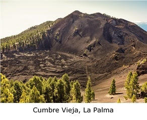
Today, in La Palma, one of the Canary Islands, Cumbre Vieja volcano erupted.

This whole island, which is also known as 'The Beautiful Island', has a volcanic composition, and this fact predicts that this eruption will be catastrophic, and the lava will probably take away homes and crop fields.

The Grandma has visited this island many times, and she loves it a lot. La Palma is a wonderful place, with a fascinating history and a charming and welcoming people, proud of its origins, its culture and its lifestyle.

Lots of strength for La Palma and for the whole Canary Nation!

More information: San Miguel de La Palma, The Beautiful Island

A volcano is a rupture in the crust of a planetary-mass object, such as Earth, that allows hot lava, volcanic ash, and gases to escape from a magma chamber below the surface.

On Earth, volcanoes are most often found where tectonic plates are diverging or converging, and most are found underwater. For example, a mid-ocean ridge, such as the Mid-Atlantic Ridge, has volcanoes caused by divergent tectonic plates whereas the Pacific Ring of Fire has volcanoes caused by convergent tectonic plates.

Volcanoes can also form where there is stretching and thinning of the crust's plates, such as in the East African Rift and the Wells Gray-Clearwater volcanic field and Rio Grande Rift in North America.

Volcanism away from plate boundaries has been postulated to arise from upwelling diapirs from the core–mantle boundary, 3,000 kilometres deep in the Earth. This results in hotspot volcanism, of which the Hawaiian hotspot is an example. Volcanoes are usually not created where two tectonic plates slide past one another.

Large eruptions can affect atmospheric temperature, as ash and droplets of sulphuric acid obscure the Sun and cool the Earth's troposphere. Historically, large volcanic eruptions have been followed by volcanic winters, which have caused catastrophic famines.

The word volcano is derived from the name of Vulcano, a volcanic island in the Aeolian Islands of Sicily whose name in turn comes from Vulcan, the god of fire in Roman mythology. The study of volcanoes is called volcanology, sometimes spelled vulcanology.

According to the theory of plate tectonics, Earth's lithosphere, its rigid outer shell, is broken into sixteen larger plates and several smaller plates. These are in slow motion, due to convection in the underlying ductile mantle, and most volcanic activity on Earth takes place along plate boundaries, where plates are converging (and lithosphere is being destroyed) or are diverging (and new lithosphere is being created).

At the mid-ocean ridges, two tectonic plates diverge from one another as hot mantle rock creeps upwards beneath the thinned oceanic crust. The decrease of pressure in the rising mantle rock leads to adiabatic expansion and the partial melting of the rock, causing volcanism and creating new oceanic crust. Most divergent plate boundaries are at the bottom of the oceans, and so most volcanic activity on the Earth is submarine, forming new seafloor.

Black smokers (also known as deep sea vents) are evidence of this kind of volcanic activity. Where the mid-oceanic ridge is above sea level, volcanic islands are formed, such as Iceland.

More information: Smithsonian Institute-Global Volcanism Program

Subduction zones are places where two plates, usually an oceanic plate and a continental plate, collide. The oceanic plate subducts (dives beneath the continental plate), forming a deep ocean trench just offshore. In a process called flux melting, water released from the subducting plate lowers the melting temperature of the overlying mantle wedge, thus creating magma.

This magma tends to be extremely viscous because of its high silica content, so it often does not reach the surface but cools and solidifies at depth. When it does reach the surface, however, a volcano is formed. Thus, subduction zones are bordered by chains of volcanoes called volcanic arcs. Typical examples are the volcanoes in the Pacific Ring of Fire, such as the Cascade Volcanoes or the Japanese Archipelago, or the Sunda Arc of Indonesia.

Hotspots are volcanic areas thought to be formed by mantle plumes, which are hypothesized to be columns of hot material rising from the core-mantle boundary.

As with mid-ocean ridges, the rising mantle rock experiences decompression melting, which generates large volumes of magma. Because tectonic plates move across mantle plumes, each volcano becomes inactive as it drifts off the plume, and new volcanoes are created where the plate advances over the plume.

The Hawaiian Islands are thought to have been formed in such a manner, as has the Snake River Plain, with the Yellowstone Caldera being the part of the North American plate currently above the Yellowstone hotspot. However, the mantle plume hypothesis has been questioned.

Sustained upwelling of hot mantle rock can develop under the interior of a continent and lead to rifting. Early stages of rifting are characterized by flood basalts and may progress to the point where a tectonic plate is completely split.

A divergent plate boundary then develops between the two halves of the split plate. However, rifting often fails to completely split the continental lithosphere, such as in an aulacogen, and failed rifts are characterized by volcanoes that erupt unusual alkali lava or carbonatites. Examples include the volcanoes of the East African Rift.

More information: BBC


 Nature is so powerful, so strong.
Capturing its essence is not easy
-your work becomes a dance with light and the weather.
It takes you to a place within yourself.

Annie Leibovitz