Showing posts with label Canary Islands. Show all posts

Sunday, 19 September 2021

CUMBRE VIEJA, AN EARTHQUAKE SWARM IN LA PALMA

Today, in La Palma, one of the Canary Islands, Cumbre Vieja volcano erupted.

This whole island, which is also known as 'The Beautiful Island', has a volcanic composition, and this fact predicts that this eruption will be catastrophic, and the lava will probably take away homes and crop fields.

The Grandma has visited this island many times, and she loves it a lot. La Palma is a wonderful place, with a fascinating history and a charming and welcoming people, proud of its origins, its culture and its lifestyle.

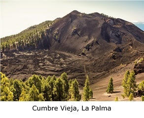
Lots of strength for La Palma and for the whole Canary Nation!

More information: San Miguel de La Palma, The Beautiful Island

A volcano is a rupture in the crust of a planetary-mass object, such as Earth, that allows hot lava, volcanic ash, and gases to escape from a magma chamber below the surface.

On Earth, volcanoes are most often found where tectonic plates are diverging or converging, and most are found underwater. For example, a mid-ocean ridge, such as the Mid-Atlantic Ridge, has volcanoes caused by divergent tectonic plates whereas the Pacific Ring of Fire has volcanoes caused by convergent tectonic plates.

Volcanoes can also form where there is stretching and thinning of the crust's plates, such as in the East African Rift and the Wells Gray-Clearwater volcanic field and Rio Grande Rift in North America.

Volcanism away from plate boundaries has been postulated to arise from upwelling diapirs from the core–mantle boundary, 3,000 kilometres deep in the Earth. This results in hotspot volcanism, of which the Hawaiian hotspot is an example. Volcanoes are usually not created where two tectonic plates slide past one another.

Large eruptions can affect atmospheric temperature, as ash and droplets of sulphuric acid obscure the Sun and cool the Earth's troposphere. Historically, large volcanic eruptions have been followed by volcanic winters, which have caused catastrophic famines.

The word volcano is derived from the name of Vulcano, a volcanic island in the Aeolian Islands of Sicily whose name in turn comes from Vulcan, the god of fire in Roman mythology. The study of volcanoes is called volcanology, sometimes spelled vulcanology.

According to the theory of plate tectonics, Earth's lithosphere, its rigid outer shell, is broken into sixteen larger plates and several smaller plates. These are in slow motion, due to convection in the underlying ductile mantle, and most volcanic activity on Earth takes place along plate boundaries, where plates are converging (and lithosphere is being destroyed) or are diverging (and new lithosphere is being created).

At the mid-ocean ridges, two tectonic plates diverge from one another as hot mantle rock creeps upwards beneath the thinned oceanic crust. The decrease of pressure in the rising mantle rock leads to adiabatic expansion and the partial melting of the rock, causing volcanism and creating new oceanic crust. Most divergent plate boundaries are at the bottom of the oceans, and so most volcanic activity on the Earth is submarine, forming new seafloor.

Black smokers (also known as deep sea vents) are evidence of this kind of volcanic activity. Where the mid-oceanic ridge is above sea level, volcanic islands are formed, such as Iceland.

More information: Smithsonian Institute-Global Volcanism Program

Subduction zones are places where two plates, usually an oceanic plate and a continental plate, collide. The oceanic plate subducts (dives beneath the continental plate), forming a deep ocean trench just offshore. In a process called flux melting, water released from the subducting plate lowers the melting temperature of the overlying mantle wedge, thus creating magma.

This magma tends to be extremely viscous because of its high silica content, so it often does not reach the surface but cools and solidifies at depth. When it does reach the surface, however, a volcano is formed. Thus, subduction zones are bordered by chains of volcanoes called volcanic arcs. Typical examples are the volcanoes in the Pacific Ring of Fire, such as the Cascade Volcanoes or the Japanese Archipelago, or the Sunda Arc of Indonesia.

Hotspots are volcanic areas thought to be formed by mantle plumes, which are hypothesized to be columns of hot material rising from the core-mantle boundary.

As with mid-ocean ridges, the rising mantle rock experiences decompression melting, which generates large volumes of magma. Because tectonic plates move across mantle plumes, each volcano becomes inactive as it drifts off the plume, and new volcanoes are created where the plate advances over the plume.

The Hawaiian Islands are thought to have been formed in such a manner, as has the Snake River Plain, with the Yellowstone Caldera being the part of the North American plate currently above the Yellowstone hotspot. However, the mantle plume hypothesis has been questioned.

Sustained upwelling of hot mantle rock can develop under the interior of a continent and lead to rifting. Early stages of rifting are characterized by flood basalts and may progress to the point where a tectonic plate is completely split.

A divergent plate boundary then develops between the two halves of the split plate. However, rifting often fails to completely split the continental lithosphere, such as in an aulacogen, and failed rifts are characterized by volcanoes that erupt unusual alkali lava or carbonatites. Examples include the volcanoes of the East African Rift.

More information: BBC


 Nature is so powerful, so strong.
Capturing its essence is not easy
-your work becomes a dance with light and the weather.
It takes you to a place within yourself.

Annie Leibovitz

Monday, 13 January 2020

'SICUT DUDUM', GUANCHE SLAVERY IN CANARY ISLANDS

Sicut Dudum, January 13, 1435, Florence
Today, The Grandma has received the visit of her closer friend Nuria. Nuria is from Tenerife, Canary Islands.

They have been talking about their lives and their future projects and Nuria has been explained to The Grandma an interesting story about Sicut dudum, a papal bull promulgated by Pope Eugene IV on a day like today in 1435, which forbade the enslavement of Guanches, the local natives in the Canary Islands who had converted or were converting to Christianity.

Canary Islands have an amazing an exciting history that must be explained and remembered. Their native people, Guanches, suffered all kind of repression -including genocide- by the Spanish colonizers who wanted to submit these peoples to the Spanish culture and religion.

Sicut dudum, in English Just as Long Ago, is a papal bull promulgated by Pope Eugene IV in Florence on January 13, 1435, which forbade the enslavement of local natives in the Canary Islands who had converted or were converting to Christianity.

Sicut dudum was meant to reinforce Creator Omnium, issued the previous year, condemning Portuguese slave raids in the Canary Islands. Over forty years after Creator omnium and Sicut dudum, Pope Sixtus IV found it necessary to repeat the prohibition in his papal bull Regimini gregis, which threatened the excommunication of all captains or pirates who enslaved Christians.

Christianity had gained many converts in the Canary Islands by the early 1430s. The ownership of the lands had been the subject of dispute between Portugal and the Kingdom of Castille. The lack of effective control had resulted in periodic raids on the islands to procure slaves.

Acting on a complaint by Fernando Calvetos, bishop of the islands, Pope Eugene IV issued a papal bull, Creator omnium, on 17 December 1434, annulling previous permission granted to Portugal to conquer those islands still pagan. Eugene excommunicated anyone who enslaved newly converted Christians, the penalty to stand until the captives were restored to their liberty and possessions.

 
Slave raids continued in the islands during 1435 and Eugene issued a further edict (Sicut dudum) that affirmed the ban on enslavement, and ordered, under pain of excommunication, that all such slaves be immediately set free:

We order and command all and each of the faithful of each sex, within the space of fifteen days of the publication of these letters in the place where they live, that they restore to their earlier liberty all and each person of either sex who were once residents of said Canary Islands, and made captives since the time of their capture, and who have been made subject to slavery. These people are to be totally and perpetually free, and are to be let go without the exaction or reception of money.

Eugene went on to say that, If this is not done when the fifteen days have passed, they incur the sentence of excommunication by the act itself, from which they cannot be absolved, except at the point of death, even by the Holy See, or by any Spanish bishop, or by the aforementioned Ferdinand, unless they have first given freedom to these captive persons and restored their goods.

The specific reference to Spanish bishops and Bishop Ferdinand of San Marcial del Rubicón in Lanzarote suggests that the Portuguese were not the only ones engaged in slave raids in the Canaries.

Joel S. Panzer views Sicut dudum as a significant condemnation of slavery, issued sixty years before the Europeans found the New World.

Eugene tempered Sicut dudum with another bull (15 September 1436) due to the complaints made by King Duarte of Portugal, that allowed the Portuguese to conquer any unconverted parts of the Canary Islands. The king suggested that Portugal be authorized to evangelize and civilize the islands, as other less reputable persons were unlikely to heed the pontiff. Political weakness compelled the Renaissance Papacy to adopt an acquiescent and unchallenging position when approached for requests for privileges in favour of these ventures. Without a navy of his own to police the islands, the Pope opted in favor of the Portuguese as the lesser of two evils.

In 1476 Pope Sixtus IV reiterated the concerns expressed in Sicut dudum in his papal bull, Regimini gregis, in which he threatened to excommunicate all captains or pirates who enslaved Christians.

More information: Papal Encyclicals Online


Freedom means you are unobstructed
in living your life as you choose.
Anything less is a form of slavery.

Wayne Dyer

Monday, 12 August 2019

TRADE WINDS, 'VIENTOS ALISIOS' IN CANARY ISLANDS

Trade winds
The Grandma suffers insomnia. The night has got high temperatures again and although there is a soft wind, the level of humidity is too high that it seems another sleepless night is coming. She has studied a new lesson of her Ms. Excel course but it hasn't been enough to start to sleep.

An important fire is affecting Gran Canaria, one of the Canary Islands and The Grandma is following this disaster since the moment it started. She has been reading a lot of information about the fire and she has been very interested in knowing more things about los alisios, some winds that affect these islands also known as the trade winds.

Chapter 12. Graphics (I) (Spanish Version)

Los alisios or the trade winds are the prevailing pattern of surface winds from the east toward the west -easterly- found in the tropics, within the lower portion of the Earth's atmosphere, in the lower part of the troposphere near the Earth's equator.

The trade winds blow predominantly from the northeast in the Northern Hemisphere and from the southeast in the Southern Hemisphere, strengthening during the winter and when the Arctic oscillation is in its warm phase.

Trade winds have been used by captains of sailing ships to cross the world's oceans for centuries, and enabled colonial expansion into the Americas and trade routes to become established across the Atlantic and Pacific oceans.

More information: National Ocean Service

In meteorology, the trade winds act as the steering flow for tropical storms that form over the Atlantic, Pacific, and southern Indian Oceans and make landfall in North America, Southeast Asia, and Madagascar and eastern Africa, respectively.

Trade winds also transport African dust westward across the Atlantic Ocean into the Caribbean Sea, as well as portions of southeastern North America. Shallow cumulus clouds are seen within trade wind regimes, and are capped from becoming taller by a trade wind inversion, which is caused by descending air aloft from within the subtropical ridge. The weaker the trade winds become, the more rainfall can be expected in the neighboring landmasses.

The term trade winds originally derives from the early fourteenth century late Middle English word trade, meaning path or track. The Portuguese recognized the importance of the trade winds -then the Volta do mar, meaning in Portuguese turn of the sea but also return from the sea -in navigation in both the north and south Atlantic ocean as early as the 15th century. 

Trade winds
From West Africa, the Portuguese had to sail away from continental Africa, that is, to west and northwest. They could then turn northeast, to the area around the Azores islands, and finally east to mainland Europe.

They also learned that to reach South Africa, they needed to go far out in the ocean, head for Brazil, and around 30°S go east again. Following the African coast southbound means upwind in the Southern hemisphere.

In the Pacific ocean, the full wind circulation, which included both the trade wind easterlies and higher-latitude Westerlies, was unknown to Europeans until Andres de Urdaneta's voyage in 1565.

The captain of a sailing ship seeks a course along which the winds can be expected to blow in the direction of travel. During the Age of Sail, the pattern of prevailing winds made various points of the globe easy or difficult to access, and therefore had a direct effect on European empire-building and thus on modern political geography. For example, Manila galleons could not sail into the wind at all.

By the 18th century, the importance of the trade winds to England's merchant fleet for crossing the Atlantic Ocean had led both the general public and etymologists to identify the name with a later meaning of trade, foreign commerce. Between 1847 and 1849, Matthew Fontaine Maury collected enough information to create wind and current charts for the world's oceans.

More information: Star Excursions

As part of the Hadley cell, surface air flows toward the equator while the flow aloft is towards the poles. A low-pressure area of calm, light variable winds near the equator is known as the doldrums, near-equatorial trough, intertropical front, or the Intertropical Convergence Zone. When located within a monsoon region, this zone of low pressure and wind convergence is also known as the monsoon trough.

Around 30° in both hemispheres, air begins to descend toward the surface in subtropical high-pressure belts known as subtropical ridges. The subsident sinking air is relatively dry because as it descends, the temperature increases, but the absolute humidity remains constant, which lowers the relative humidity of the air mass. This warm, dry air is known as a superior air mass and normally resides above a maritime tropical, warm and moist, air mass. An increase of temperature with height is known as a temperature inversion. When it occurs within a trade wind regime, it is known as a trade wind inversion.

Trade winds
The surface air that flows from these subtropical high-pressure belts toward the Equator is deflected toward the west in both hemispheres by the Coriolis effect. These winds blow predominantly from the northeast in the Northern Hemisphere and from the southeast in the Southern Hemisphere.

Because winds are named for the direction from which the wind is blowing, these winds are called the northeasterly trade winds in the Northern Hemisphere and the southeasterly trade winds in the Southern Hemisphere. The trade winds of both hemispheres meet at the doldrums.

As they blow across tropical regions, air masses heat up over lower latitudes due to more direct sunlight. Those that develop over land -continental- are drier and hotter than those that develop over oceans -maritime-, and travel northward on the western periphery of the subtropical ridge. Maritime tropical air masses are sometimes referred to as trade air masses. The one region of the Earth which has an absence of trade winds is the north Indian ocean.

Clouds which form above regions within trade wind regimes are typically composed of cumulus which extend no more than 4 kilometres in height, and are capped from being taller by the trade wind inversion.

Trade winds originate more from the direction of the poles -northeast in the Northern Hemisphere, southeast in the Southern Hemisphere- during the cold season, and are stronger in the winter than the summer.

More information: Tourist Guide

As an example, the windy season in the Guianas, which lie at low latitudes in South America, occurs between January and April. When the phase of the Arctic oscillation (AO) is warm, trade winds are stronger within the tropics. The cold phase of the AO leads to weaker trade winds. When the trade winds are weaker, more extensive areas of rain fall upon landmasses within the tropics, such as Central America.

During mid-summer in the Northern Hemisphere (July), the westward-moving trade winds south of the northward-moving subtropical ridge expand northwestward from the Caribbean sea into southeastern North America (Florida and Gulf Coast). When dust from the Sahara moving around the southern periphery of the ridge travels over land, rainfall is suppressed and the sky changes from a blue to a white appearance which leads to an increase in red sunsets. Its presence negatively impacts air quality by adding to the count of airborne particulates.

Although the Southeast USA has some of the cleanest air in North America, much of the African dust that reaches the United States affects Florida. Since 1970, dust outbreaks have worsened due to periods of drought in Africa. There is a large variability in the dust transport to the Caribbean and Florida from year to year. Dust events have been linked to a decline in the health of coral reefs across the Caribbean and Florida, primarily since the 1970s.

More information: Meteoblue


 No wind serves him who addresses 
his voyage to no certain port.

Michel de Montaigne

Saturday, 16 March 2019

LANZAROTE, THE FIRST CANARY ISLAND TO BE SETTLED

The Grandma arrives to Arrecife, Lanzarote
Today, The Grandma and her friends have arrived to Arrecife, the capital and main city of Lanzarote. They are going to visit this wonderful island, the last visit in their travel around the Canary Islands.

Lanzarote is an amazing place for nature lovers and the friends are going to visit the most spectacular places and enjoy the local cuisine. They are very happy with this experience but sad because it is going to end soon.

During the travel from Fuerteventura to Lanzarote, The Grandma has studied a new lesson of her Intermediate Language Practice manual (Grammar 34).

More information: Articles 1

Lanzarote is the northernmost and easternmost island of the autonomous Canary Islands in the Atlantic Ocean. It is located approximately 125 kilometres off the north coast of Africa and 1,000 kilometres from the Iberian Peninsula. Covering 845.94 square kilometres, Lanzarote is the fourth-largest of the islands in the archipelago. In the centre-west of the island is Timanfaya National Park, one of its main attractions. The capital is Arrecife.

The first recorded name for the island, given by Italian-Majorcan cartographer Angelino Dulcert, was Insula de Lanzarotus Marocelus, after the Genoese navigator Lancelotto Malocello, from which the modern name is derived. The island's name in the native language was Tyterogaka or Tytheroygaka, which may mean one that is all ochre, referring to the island's predominant colour.

Claire Fontaine & the local plants, Lanzarote
Lanzarote is located 11 kilometres north-east of Fuerteventura and just over 1 kilometre from Graciosa. The dimensions of the island are 60 kilometres from north to south and 25 kilometres from west to east. Lanzarote has 213 kilometres of coastline, of which 10 kilometres are sand, 16.5 kilometres are beach, and the remainder is rocky.

Its landscape includes the mountain ranges of Famara (671 metres) in the north and Ajaches (608 metres) to the south. South of the Famara massif is the El Jable desert, which separates Famara and Montañas del Fuego. The highest peak is Peñas del Chache, rising to 670 metres above sea level. The Tunnel of Atlantis, the largest underwater volcanic tunnel in the world, is part of the Cueva de los Verdes lava tube.

More information: Turismo Lanzarote

Often called the Island of Eternal Spring, Lanzarote has a subtropical-desert climate according to the Köppen climatic classification. The small amount of precipitation is mainly concentrated in the winter. Rainfall during summer is a rare phenomenon and several summers are completely dry without any precipitation. On average the island receives approximately 16 days of precipitation between December and February. Sometimes, the hot sirocco wind prevails, causing dry and dusty conditions across the island. Average precipitation in June and August is less than 0.5 millimetres. It closely borders on a tropical climate, with winter means of 18 °C and summer means of 25 °C.

Lanzarote is the northernmost and easternmost island of the Canary Islands and has a volcanic origin. It was born through fiery eruptions and has solidified lava streams as well as extravagant rock formations.

Joseph de Ca'th Lon & local plants, Lanzarote
The island emerged about 15 million years ago as product of the Canary hotspot. The island, along with others, emerged after the breakup of the African and the American continental plates. The greatest recorded eruptions occurred between 1730 and 1736 in the area now designated Timanfaya National Park.

There are five hundred different kinds of plants on the island, of which 17 species are endemic. These plants have adapted to the relative scarcity of water in the same way as succulents. They include the Canary Island date palm (Phoenix canariensis), which is found in damper areas of the north, the Canary Island pine (Pinus canariensis), ferns, and wild olive trees (Olea europaea). Laurisilva trees, which once covered the highest parts of Risco de Famara, are rarely found today. After winter rainfall, the vegetation comes to a colourful bloom between February and March.

The vineyards of La Gería, Lanzarote DO wine region, are a protected area. Single vines are planted in pits 4–5 metres wide and 2–3 metres deep, with small stone walls around each pit. This agricultural technique is designed to harvest rainfall and overnight dew and to protect the plants from the winds.

More information: Hello Canary Islands

There are 180 different species of lichen-forming fungi. These survive in the suitable areas like rock surfaces, and promote weathering.

Apart from the native bats and the mammals which accompanied humans to the island, including the dromedary, which was used for agriculture and is now a tourist attraction, there are few vertebrate species on Lanzarote. These include birds, such as falcons, and reptiles.

Tina Picotes visits Arrecfife, Lanzarote
Some interesting endemic animals are the Gallotia lizards and the blind Munidopsis polymorpha crabs found in the Jameos del Agua lagoon, which was formed by a volcanic eruption.

The island is also home to one of two surviving populations of the threatened Canarian Egyptian vulture.

The official natural symbols associated with Lanzarote are Munidopsis polymorpha (Blind crab) and Euphorbia balsamifera (Tabaiba dulce).

Lanzarote is believed to have been the first Canary Island to be settled. The Phoenicians may have visited or settled there, though no material evidence survives. The first known record came from Roman author Pliny the Elder in the encyclopaedia Naturalis Historia on an expedition to the Canary Islands.

More information: Lanzarote Guide

The names of the islands, then called Insulae Fortunatae or the Fortunate Isles, were recorded as Junonia (Fuerteventura), Canaria (Gran Canaria), Ninguaria (Tenerife), Junonia Major (La Palma), Pluvialia (El Hierro), and Capraria (La Gomera).

Lanzarote and Fuerteventura, the two easternmost Canary Islands, were only mentioned as the archipelago of the purple islands. The Roman poet Lucan and the Greek astronomer and geographer Ptolemy gave their precise locations. It was settled by the Majos tribe of the Guanches. After the fall of the Western Roman Empire, the Canary Islands were ignored until 999, when the Arabs arrived at the island which they dubbed al-Djezir al-Khalida, among other names.

Tonyi Tamaki visits Arrecife, Lanzarote
In 1336, a ship arrived from Lisbon under the guidance of Genoese navigator Lancelotto Malocello, who used the alias Lanzarote da Framqua. A fort was later built in the area of Montaña de Guanapay near today's Teguise.

Castilian slaving expeditions in 1385 and 1393 seized hundreds of Guanches and sold them in Spain, initiating the slave trade in the islands. French explorer Jean de Béthencourt arrived in 1402, heading a private expedition under Castilian auspices. Bethencourt first visited the south of Lanzarote at Playas de Papagayo, and the French overran the island within a matter of months. The island lacked mountains and gorges to serve as hideouts for the remaining Guanche population, and so many Guanches were taken away as slaves that only 300 Guanche men were said to have remained.

At the southern end of the Yaiza municipality, the first European settlement in the Canary Islands appeared in 1402 in the area known as El Rubicón, where the conquest of the Archipelago began. In this place, the Cathedral of Saint Martial of Limoges was built. The cathedral was destroyed by English pirates in the 16th century. A diocese was moved in 1483 to Las Palmas de Gran Canaria (Roman Catholic Diocese of Canarias).

More information: Lonely Planet

In 1404, the Castilians, with the support of the King of Castile, came and fought the local Guanches, who were further decimated. The islands of Fuerteventura and El Hierro were later similarly conquered. In 1477, a decision by the royal council of Castile confirmed a grant of Lanzarote and Fuerteventura, with the smaller islands of Ferro and Gomera to the Castilian nobles Herrera, who held their fief until the end of the 18th century.

In 1585, the Ottoman admiral Murat Reis temporarily seized Lanzarote. In the 17th century, pirates raided the island and took 1,000 inhabitants into slavery in Cueva de los Verdes.

Jordi Santanyí visits Lanzarote
From 1730 to 1736, the island was hit by a series of volcanic eruptions, producing 32 new volcanoes in a stretch of 18 kilometres. The priest of Yaiza, Don Andrés Lorenzo Curbelo, documented the eruption in detail until 1731. Lava covered a quarter of the island's surface, including the most fertile soil and 11 villages.

100 smaller volcanoes were located in the area called Montañas del Fuego, the Mountains of Fire. In 1768, drought affected the deforested island, and winter rains did not fall. Much of the population was forced to emigrate to Cuba and the Americas, including a group which formed a significant addition to the Spanish settlers in Texas at San Antonio de Bexar in 1731.

Another volcanic eruption occurred within the range of Tiagua in 1824, which was less violent than the major eruption between 1730 and 1736.

In 1927, Lanzarote and Fuerteventura became part of the province of Las Palmas. Several archaeological expeditions have uncovered the prehistoric settlement at the archaeologic site of El Bebedero in the village of Teguise. In one of those expeditions, by a team from the University of Las Palmas de Gran Canaria and a team from the University of Zaragoza, yielded about 100 Roman potsherds, nine pieces of metal, and one piece of glass. The artefacts were found in strata dated between the 1st and 4th centuries. They show that Romans did trade with the Canarians, though there is no evidence of settlements.

The island has a UNESCO Biosphere Reserve protected site status. UNESCO has threatened to revoke Lanzarote's Biosphere Reserve status, if the developments are not respecting local needs and are impacting on the environment.

More information: The Telegraph


 Climate change, migration...
they transcend national borders 
and require an international response.

Taavet Hinrikus

Tuesday, 12 March 2019

ALFREDO KRAUS TRUJILLO, 'POURQUOI ME RÉVEILLER?'

Arriving to The Alfredo Kraus Auditorium, Las Palmas
After visiting Maspalomas, The Grandma and her friends are going to go to The Alfredo Kraus Auditorium, built in 1997 to homage the Canary tenor.

The Grandma loves opera and she likes Alfredo Kraus a lot. It is an enormous pleasure for her to visit this emblematic place and to remember who is considered one of the best tenors of the end of the 20th century. She will never forget Alfredo Kraus's performances in the Liceu in Barcelona.

Before going to the opera, The Grandma has studied a new lesson of her Intermediate Language Practice manual (Grammar 29).

More information: It and There

Alfredo Kraus Trujillo (24 November 1927-10 September 1999) was a distinguished Spanish tenor from the Canary Islands, known professionally as Alfredo Kraus, particularly known for the artistry he brought to opera's bel canto roles. He was also considered an outstanding interpreter of the title role in Massenet's opera Werther, and especially of its famous aria, Pourquoi me réveiller?

Kraus was born in Las Palmas de Gran Canaria. His father was Austrian and his mother was Canarian. He began his musical career with piano lessons at the age of four, and he sang in the school choir by age eight. His older brother, Francisco Kraus Trujillo, a baritone, studied music and opera alongside him.

Alfredo Kraus
After refining his technique singing Spanish zarzuela on stage in Madrid and Barcelona, Kraus made his professional opera debut in Cairo during 1956 as the Duke in Rigoletto, which became one of his signature roles.

In 1958, he sang Alfredo at the Teatro Nacional de São Carlos in Lisbon in a production of La traviata with Maria Callas, a live recording of which was later released.

Kraus made his Covent Garden debut as Edgardo in Lucia di Lammermoor in 1959 and his La Scala debut as Elvino in La sonnambula in 1960. He made his American debut with Lyric Opera of Chicago in 1962, and his Metropolitan Opera debut in 1966 in Rigoletto, the role of his last performance there in 1994.

In subsequent decades, Kraus extended his repertoire to include more Italian operas such as Lucrezia Borgia, La fille du régiment, Linda di Chamounix, Don Pasquale and La favorita by Donizetti; and French operas such as Roméo et Juliette, Les contes d'Hoffmann, Faust and Lakmé, while continuing to sing his hallmark roles of Werther and of Des Grieux in Manon.


More information: Gran Canaria

He also recorded a number of rarely performed French operas including La jolie fille de Perth and Les pêcheurs de perles, both by Georges Bizet, and La muette de Portici by Daniel Auber. He also performed in some very well known works, such as Don Giovanni and Faust.

Kraus came to be virtually synonymous with such lyric tenor roles as Werther, Faust, Don Ottavio (Don Giovanni), Nemorino, and Arturo. He was also known for his performances of Spanish music, notably many classics from the zarzuela repertoire, which he continued to perform live on stage in Spain until the end of his career, and many of which he recorded complete for EMI Spain as well as for his own label, Carillon.


Callas & Kraus, La Traviata, Lisbon
Thanks to his superlative technique and careful husbanding of his vocal resources, Kraus sang onstage until his early 70s. He studied voice technique in Milan with Mercedes Llopart.

Kraus
was also noted for extremely refined musicianship, accompanied by a seemingly effortless high register.


As a result, many opera connoisseurs consider him to be one of the best tenors of the end of the 20th century. He was admired for his cultivated musical education and his complete respect for his chosen profession.

His first priority was the integrity of his artistic interpretation of a piece, rather than his formidable range and excellent technique.

He performed all over the world, including the Teatro Colón in Buenos Aires, Teatro Municipal in Caracas, Teatro Municipal in Santiago, Chile, Teatro Municipal in Rio de Janeiro, and the Liceu in Barcelona.

In 1997, his home city of Las Palmas de Gran Canaria opened The Alfredo Kraus Auditorium in his honor.

The loss of his wife in 1997 affected Kraus so deeply that he stopped performing for eight months. A proud and strong-willed man, he eventually returned to the stage and to teaching. He said, I don't have the will for singing but I must do it, because, in a sense, it is a sign that I have overcome the tragedy. Singing is a form of admitting that I'm alive.

Kraus died on 10 September 1999 in Madrid, at the age of 71, after a long illness.


You have to make a choice when you start to sing
and decide whether you want to service the music,
and be at the top of your art,
or if you want to be a very popular tenor.

Alfredo Kraus

Saturday, 9 March 2019

LAS PALMAS, ENJOY THE BEST CLIMATE IN THE WORLD

Visiting Las Palmas de Gran Canaria, Canary Islands
Today, The Grandma and her friends are visiting Las Palmas, the capital city of Gran Canaria.  

Las Palmas is a beautiful city and the friends have been taken some photos for their own digital albums.

Before visiting Las Palmas, The Grandma has studied a new lesson of her Intermediate Language Practice manual (Grammar 26).

More information: Relative Clauses II

Las Palmas, officially Las Palmas de Gran Canaria, is a city and capital of Gran Canaria island, in the Canary Islands, on the Atlantic Ocean.

It is the capital jointly with Santa Cruz de Tenerife, the most populous city in the Canary Islands.

Las Palmas is located in the northeastern part of the island of Gran Canaria, about 150 km off the Moroccan coast in the Atlantic Ocean. Las Palmas experiences a hot desert climate, offset by the local cooler Canary Current, with warm temperatures throughout the year. It has an average annual temperature of 21.2 °C.

According to a study carried out by Thomas Whitmore, director of research on climatology at Syracuse University in the U.S., Las Palmas enjoys the best climate in the world.

Jordi Santanyí visits Las Palmas de Gran Canaria
The city was founded in 1478, and considered the de facto without legal recognition capital of the Canary Islands until the seventeenth century.

It is the home of the Canarian Ministry of Presidency, shared in a four-year term with Santa Cruz de Tenerife, as well as half of the ministries and boards of the Canarian government, and the High Court of Justice of the Canary Islands.

The city was founded by Juan Rejón on 24 June 1478, with the name Real de Las Palmas. Rejón was head of the invading Castilian army, which then engaged in war with the locals.

In 1492, Christopher Columbus anchored in the port of Las Palmas and spent some time on the island on his first trip to the Americas. The Colón House museum in the Vegueta area of the city is named after him.

In 1595, Francis Drake tried to plunder the town, leading to the Battle of Las Palmas. A Dutch raid under vice-admiral Pieter van der Does in 1599 was only slightly more successful; some of the town was destroyed, but the raiders were repelled.

More information: Gran Canaria

Las Palmas' seaport, Puerto de la Luz, known internationally as La Luz port, benefited greatly from the closure of the Suez Canal during the Suez Crisis. Many foreign workers migrated to the city at this time.

Las Palmas is a sister city of San Antonio, Texas, in the United States, which was founded in 1718 by about 25 Canary Islanders.

Las Palmas is divided into five administrative districts, which in turn are subdivided into districts, not necessarily consistent with the traditional neighborhoods: Vegueta, Cono Sur y Tafira; Centro; La Isleta-Puerto-Canteras; Ciudad Alta and Tamaraceite-San Lorenzo. 

Las Palmas has a desert climate with warm dry summers and warm enough winters to classify it as a Tropical climate.  

Joseph contemplates some statues in Las Palmas
Its average annual temperature is 21.2 °C-28 °C during the day and 18 °C at night. 

In January, the coldest month, the temperature typically ranges from 19 to 23 °C, and sometimes higher during the day, and around 15 to 16 °C at night, with an average sea temperature at 20 °C. In the warmest months -August and September- the temperature typically ranges from 27 to 30 °C during the day, above 21 °C at night, with the average sea temperature at 23 °C. Large fluctuations in temperature are rare.

August 1990 was the warmest month on record, with the average maximum temperature of the month during the day being 30.6 °C. The highest temperature ever recorded was 44.2 °C, and the coldest temperature ever recorded was 9.4 °C. The highest wind speed ever recorded was on 28 November 2005, measuring 113 km/h. Las Palmas city has never recorded any snow or sleet.

More information: Las Palmas de Gran Canaria

Annual average relative humidity is 66%, ranging from 64% in March to 69% in October. The amount of annual sunshine hours is above 2,800 per year, from around 190 in winter, average of 6 hours a day, to around 300 in summer, average of 10 hours a day. It rains on average only 22 days a year, with total precipitation per year of only 151 mm.

Las Palmas offers a variety of theater, cinema, opera, concerts, visual arts and dance performances. The city hosts the Canary Islands Music Festival, the Theatre and Dance and the International Film Festival. The main City Festival, celebrating the foundation of the City Fiestas de San Juan is held in June. The Carnival of Las Palmas de Gran Canaria is known worldwide, and is one of the main attractions for tourists.

The city center of Las Palmas, specifically the Vegueta and Triana neighbourhoods, are included in the tentative List of UNESCO World Heritage Sites.

More information: Visit Canary Islands


Happiness is actually found in simple things,
such as taking my nephew around the island by bicycle 
or seeing the stars at night.

Andrea Hirata

Thursday, 7 March 2019

GRAN CANARIA A.K.A. TAMARÁN, LAND OF THE BRAVE

Joseph de Ca'th Lon visits Gran Canaria
Today, The Grandma and her friends have just arrived to Las Palmas, the capital of Gran Canaria the next island that they are going to visit.

Gran Canaria is a unique island with different microclimes and they are very interested in discovering all of them.

Moreover, in Gran Canaria there is one of the 14 ground stations in the Manned Space Flight Network which supports the NASA and Joseph de Ca'th Lon wants to visit it.

During the travel from Tenerife to Las Palmas, The Grandma has studied a new lesson of her Intermediate Language Practice manual (Grammar 25).

More information: Relative Clauses I

Gran Canaria meaning Great Island of Dogs, is the second most populous of the Canary Islands.

Gran Canaria is located in the Atlantic Ocean about 150 kilometres off the northwestern coast of Africa and about 1,350 km from Europe. With an area of 1,560 km2 and an altitude of 1,956 m at the Pico de las Nieves, Gran Canaria is the third largest island of the archipelago in both area and altitude.

In Ancient History, Gran Canaria was populated by the North African Canarii, who may have arrived as early as 500 BC. The Canarii called the island Tamarán Land of the Brave.

In the Medieval period, after over a century of European incursions and attempts at conquest, the island was conquered on April 29, 1483 by the Crown of Castile, under Queen Isabella I. The conquest succeeded after a campaign that lasted five years, and it was an important step towards the expansion of the unified Spain.

The Grandma & Claire Fontaine visit Gran Canaria
The capital city of Las Palmas de Gran Canaria was founded on June 24, 1478, under the name Real de Las Palmas, by Juan Rejón, head of the invading Castilian army.

In 1492, Christopher Columbus anchored in the Port of Las Palmas, and spent some time on the island, on his first trip to the Americas. Las Palmas de Gran Canaria is, jointly with Santa Cruz de Tenerife, the capital of the Canary Islands. Gran Canaria is located southeast of Tenerife and west of Fuerteventura. The island is of volcanic origin, mostly made of fissure vents. Gran Canaria's surface area is 1,560 km² and its maximum elevation is 1,949 metres, Pico de Las Nieves. It has a round shape, with a diameter of approximately 50 km.

About 80% of the volume of the island was formed during the Miocene period eruptions, between 14 and 9 million years ago. This is called the Old Cycle and is estimated to have lasted some 200,000 years and have emitted about 1000 km3, mostly of fissural alkali basalt. This cycle continued with the emission of trachytes, phonolites and peralkaline rocks. This period was followed by one of erosion, which lasted some 4 million years.

More information: Gran Canaria

A second cycle of volcanic eruptions, known as the Roque Nublo cycle, took place between 4.5 and 3.4 million years ago. This shorter cycle emitted about 100 km3. Most of the inland peaks were formed by erosion from these materials. This period also started with fissural basalts, but ended with violent eruptions of pyroclastic flows. Some phonolitic features, like the Risco Blanco, were also formed in its last stages.

The third or recent cycle is held to have started some 2.8 million years ago and is considered to be still active. The last eruptions are held to have occurred some 3500 years ago.

The changes in volume and, therefore, weight of the island have also caused the island to rise above the previous sea level during erosive periods and to sink during eruptive periods. Some of these fossil beaches can be seen in the cliff faces of the more eroded northern coast.

Jordi & his friends visiting Gran Canaria
Until the conquest, Gran Canaria had extensive forests, but then suffered extensive deforestation as a result of continuous logging, land divisions and other intensive uses. This reduced the forest cover to just 56,000 hectares, making the island the most deforested of the Canary Islands.

Gran Canaria lies within the Province of Las Palmas, which consists of the eastern part of the Canary Islands community. Las Palmas de Gran Canaria is the provincial capital, one of the two capitals of the Canary Islands along with Santa Cruz de Tenerife.

The island of Gran Canaria is governed by the Cabildo Insular de Gran Canaria.

According to the Koppen Climate Classification, Gran Canaria is considered to have a desert climate (Bwh) due to its consistent warm temperatures and severe lack of precipitation.

More information: Hello Canary Islands

Gran Canaria is noted for its rich variety of microclimates. Generally speaking though, the average daytime high ranges from 20 °C in winter, to 26 °C in summer. Some cool nights occur in winter, but lows below 10 °C are unknown near the coast. Inland the climate is still mild but mountainous areas see the occasional frost or snow.

Annual rainfall averages 228 mm, most of this falling in the cooler months, with July, August and September normally rainless. Rainfall is unevenly distributed through the island with some areas being much drier than others. Cloud cover and sunshine is often quite variable during the cooler months, and there can be several rather cloudy days at times in winter. Summers are generally quite sunny however, with the south of the island being most favoured.

Gran Canaria agriculture is unique among the Canaries Islands in that it was traditionally dominated by plantations, with much of these being grains as well as sugarcane, rather than by stock-breeding. The caves of Valerón, a property of cultural interest in the archaeological site category, in the municipality of Santa María de Guía bears testimony of it by being the largest pre-Hispanic collective granary of the Canaries.

Tina Picotes & Claire Fontaine visit Gran Canaria
This island is called a Miniature Continent due to the different climates and variety of landscapes found, with long beaches and dunes of white sand, contrasting with green ravines and picturesque villages.

A third of the island is under protection as a Biosphere Reserve by UNESCO. The official natural symbols associated with Gran Canaria are Canis lupus familiaris (Canary Mastiff) and Euphorbia canariensis (Cardón).

Nearly half of the island territory -667 km² (42.7% of island)- is under protection from the Red Canaria de Espacios Naturales Protegidos, Canary Islands Network for Protected Natural Areas. Of the 146 protected sites under control of network in the Canary Islands archipelago, a total of 33 are located in Gran Canaria, the second most protected island in the group.  There are seven different categories of protection:

Six nature reserves -El Brezal, Azuaje, Los Tilos de Moya, Los Marteles, Las Dunas de Maspalomas and Güigüi

-Two integral nature reserves -Inagua and Barranco Oscuro

-Two natural parks -Tamadaba and Pilancones

-Two rural parks -Nublo and Doramas

-Ten natural monuments -Amagro, Bandama, Montañón Negro, Roque de Aguayro, Tauro, Arinaga, Barranco de Guayadeque, Riscos de Tirajana, Roque Nublo and Barranco del Draguillo

-Seven protected landscapes -La Isleta, in the capital Las Palmas de Gran Canaria, Pino Santo, Tafira, Las Cumbres, Lomo Magullo, Fataga and Montaña de Agüimes

-Four sites of scientific interest -Jinámar, Tufia, Roque de Gando and Juncalillo del Sur

In the 1960s, Gran Canaria was selected as the location for one of the 14 ground stations in the Manned Space Flight Network (MSFN) to support the NASA space program. Maspalomas Station, located in the south of the island, took part in a number of space missions including the Apollo 11 Moon landings and Skylab. Today it continues to support satellite communications as part of the ESA network.

More information: Visit Canary Islands


Gran Canaria... 
El alma eres de mi tierra fuego y lava junto al mar.

Gran Canaria...
You are the soul of my homeland, fire and lava next to the sea.
 
Néstor Alamo